ROVI – Inovative radar and optical satellite image time series fusion and processing for monitoring the natural environment
Principal Investigator at ZRC SAZU
Tatjana Veljanovski, PhD-
Original Title
ROVI – Združevanje in obdelava radarskih in optičnih časovnih vrst satelitskih posnetkov za spremljanje naravnega okolja
Project Team
Žiga Kokalj, PhD, assoc. prof. , Nejc Čož, PhD, Aleš Marsetič, PhD, Urša Kanjir, PhD, Liza Stančič, PhD-
ARIS Project ID
J2-3055
-
Duration
1 October 2021–30 September 2024 -
Lead Partner
University of Ljubljana (Faculty of Civil and Geodetic Engineering)
-
Project Leader
-
Financial Source

Partners
Slovenian Forestry Institute
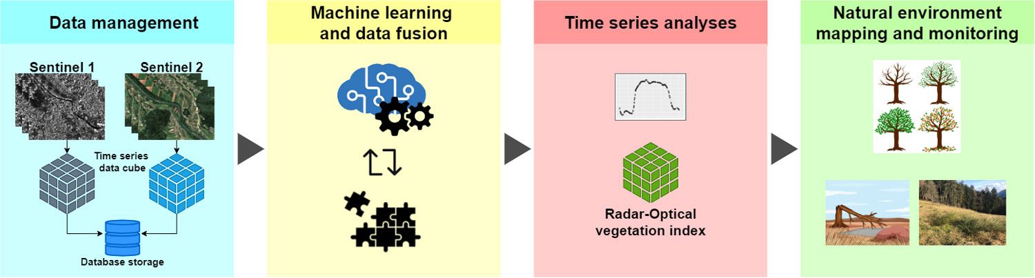
Environmental problems are becoming serious societal issues, so providing quality information to support decision-making is an increasing challenge. The project focuses on satellite monitoring of grasslands, wetlands and forests, which are important habitats as natural carbon sinks. High-quality information on the condition of these areas can improve their management and contribute to their protection. The project aims to develop a solution for the main tasks of monitoring the natural environment based on satellite data, such as identification of plant species and monitoring of vegetation development, as well as tools for phenological analysis. The project has the following objectives:
- To find a link and combine different optical (Sentinel-2) and radar (Sentinel-1) time types of satellite data. This eliminates the missing data problems we encounter when using only optical imagery (due to cloud cover) and improves the ability to observe vegetation with satellite data.
- Provide organised and verified time series of optical and radar data (analysis-ready data, ARD) and open source tools for vegetation mapping (for quality identification of vegetation type and observation of vegetation evolution).
Within the project, we will investigate and develop methods to combine multi-sensor satellite data with machine learning approaches and time series analysis methods for vegetation monitoring and gain insights into vegetation development through data mining.
For the latest project progress see the ROVI project web-page on the UL FGG internet pages.