CEOIS – Customized Earth observation based information services
Principal Investigator at ZRC SAZU
Žiga Kokalj, PhD, assoc. prof.Project Team
Tatjana Veljanovski, PhD, Liza Stančič, PhD, Aleš Grlj, Peter Pehani, Urša Kanjir, PhD-
Duration
1 December 2017–30 September 2019 -
Lead Partner
Geocodis
-
Financial Source
Evropska vesoljska agencija
The overall goal of the CEOIS project is to assist the Geospatial Operations Support Team (GOST) of the World Bank. GeoCodis and ZRC SAZU are developing an interface system between the individual ESA monitoring and safeguards projects and GOST. The system will exploit cloud infrastructure for data processing. Alongside information available on the WebMap, the user will also get the results in a form of a report, and the data on the information products will be available in a user-specified raw format (either vector, raster, or textual). GeoCodis is responsible for development of the interface system, while ZRC SAZU is providing the relevant information products:
- extent and status of dwellings of forcibly displaced persons,
- land cover extent and status, and
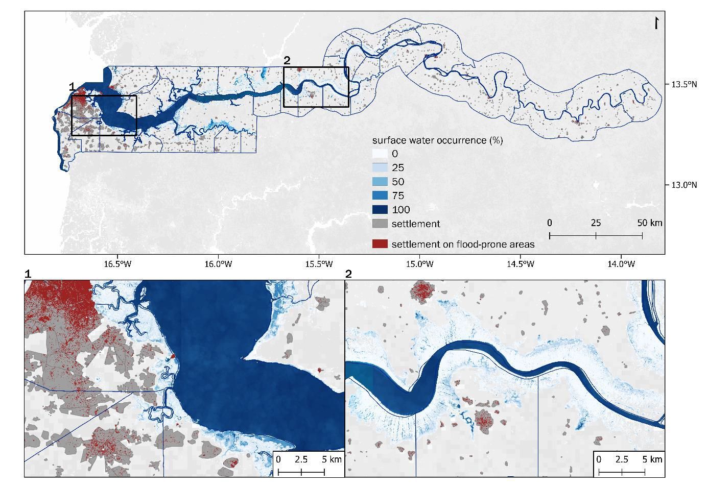
- surface water extent and flood risk assessment.
The information layers enable a quick assessment of the situation and are available for monthly and yearly intervals.
The broader areas of interest are arid zones, where there has been conflict, big population changes, and/or urban expansion, such as Iraq, Yemen, Somalia, Afghanistan, South Sudan, northern Uganda, Gambia and Burkina Faso.