Development of system for usage of remote sensing data (incl. feasibility study) – case study to monitor agricultural land (permanent grassland and soil wetness)
Principal Investigator at ZRC SAZU
Tatjana Veljanovski, PhD-
Original Title
Vzpostavitev sistema za obdelavo podatkov opazovanja Zemlje (s študijo izvedljivosti) na primeru spremljanja kmetijskih zemljišč (trajno travinje in vlažnost tal)
Project Team
Žiga Kokalj, PhD, Aleš Grlj, Liza Stančič, PhD, Maja Somrak-
Duration
6 August 2021–5 February 2023 -
Lead Partner
-
Project Leader
-
Financial Source
Statistical Office of the Republic of Slovenia

Partners
Sinergise Ltd, University of Ljubljana (Faculty of Civil and Geodetic Engineering)
The project focuses on the use of Earth observation data and the construction of a system for obtaining geoinformation for the needs of national official statistics. We use various satellite data (Sentinel, Landsat, MODIS), national data on agricultural land and existing statistical survey (census) data. We focus on determining the characteristics of permanent grassland and pastures in Slovenia (age of permanent grassland, presence of fertilisation, insemination and intensity of pasture use) and the presence of irrigation on agricultural land. For this purpose, we are developing machine learning models on time series of satellite images.
SentinelHub is an advanced environment that we use to access and process Earth observation data and implement machine learning. The aim is to create organised geodata layers from which summaries of grassland use parameters at different spatial scales (land, NUTS cohesion regions) can be obtained.
The system set up will allow the determination of various attributes of grassland and pasture use and presence of irrigation on agricultural land and will also contribute to the evaluation of the potential of Earth observation data and modern processing tools for official statistics.
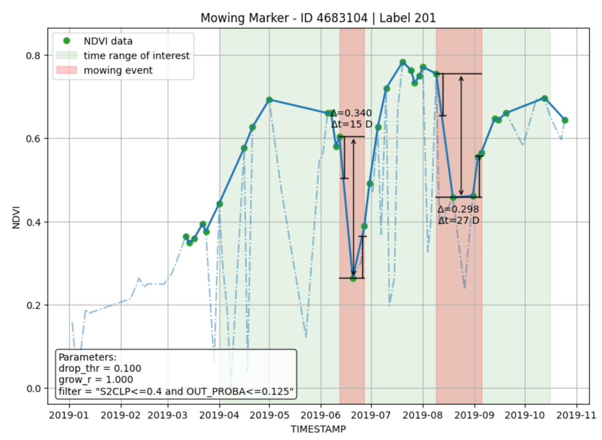
Study of possibilities to detect mowing from dense time series of vegetation index NDVI, calculated from Sentinel-2 imagery (source Sinergise: Area Monitoring — Mowing Marker)
WP1 – Project management
WP2 – Collection, selection and preparation of data sources and of processing infrastructure
WP3 – Setting-up the processing environment
WP4 – Preparation of methodologies and workflow for extracting data variables and attributes
WP5 – Integration of workflow into routine processes of SURS
WP6 – Preparation of deliverables