Feasibility study and mapping of grassland habitat types with remote sensing with emphasis on separation of intensive and extensive grasslands
Principal Investigator at ZRC SAZU
Tatjana Veljanovski, PhD-
Original Title
Testiranje možnosti in izvedba kartiranja traviščnih habitatnih tipov z daljinskim zaznavanjem s poudarkom na ločevanju intenzivnih in ekstenzivnih travnikov
-
Acronym
ZRSVN Travinje
Project Team
Žiga Kokalj, PhD, Liza Stančič, PhD, Peter Pehani-
Duration
27 June 2019–30 September 2020 -
Project Leader
-
Financial Source
Partners
University of Ljubljana (Faculty of Civil and Geodetic Engineering)
In a study on the applicability of Sentinel-1 and Sentinel-2 satellite data for mapping grassland habitat types, we investigated the potential for distinguishing between intensive and extensive grasslands. Both Sentinel-1 and Sentinel-2 imagery is freely available through the European Copernicus programme. Each of the two systems consists of two satellites, allowing high temporal resolution. The two Sentinel-1 satellites use Synthetic Aperture Radar (SAR) sensor in four different modes; they typically image the land with a spatial resolution of up to 10 m and a temporal resolution of 12 days and 6 days from April 2014 and April 2016, respectively. The two Sentinel-2 optical satellites acquire with a multispectral sensor in thirteen spectral bands, with a spatial resolution of up to 10 m. Sentinel-2 data has been available every ten days since December 2015 and every five days since July 2017.
We studied characteristics of vegetation development between March and November, for all grasslands in Slovenia, for three test years (2017, 2018 and 2019). We computed the results using machine learning on time series of satellite imagery and ancillary data. For the latter, we used the available habitat type mapping of the client IRSNC; for the definition of the study area (read: grassland polygons), we used the state data of the Register of Actual Use of Agricultural and Forest Land ("RABA") and the Graphical Unit of Agricultural Land Use ("GERK").
In this study, we tested the usefulness of freely available Sentinel-1 and Sentinel-2 satellite data, pre-processed to a spatial resolution of 10 m, for classifying grasslands according to their intensity of use. Using a semi-supervised machine learning classification on polygons of grasslands, we produced grassland maps for 2017, 2018 and 2019. The maps contain three classes: both target classes intensive grassland and extensive grassland, and an class unspecified. The latter contains land that the classification model was not able to classify into either of the two target classes. These areas represent 3% of the total observed permanent grassland, but are too small to be reliably observed with Sentinel imagery (narrow plots, small plots).
The study also resulted in the design of an approach suitable for obtaining current status of grasslands across Slovenia on an annual basis, including comparisons with status of previous years. The developed procedure – in addition to the classification into intensive and extensive grasslands – also estimated the indicative dates of mowing for each grassland for the three years under study.
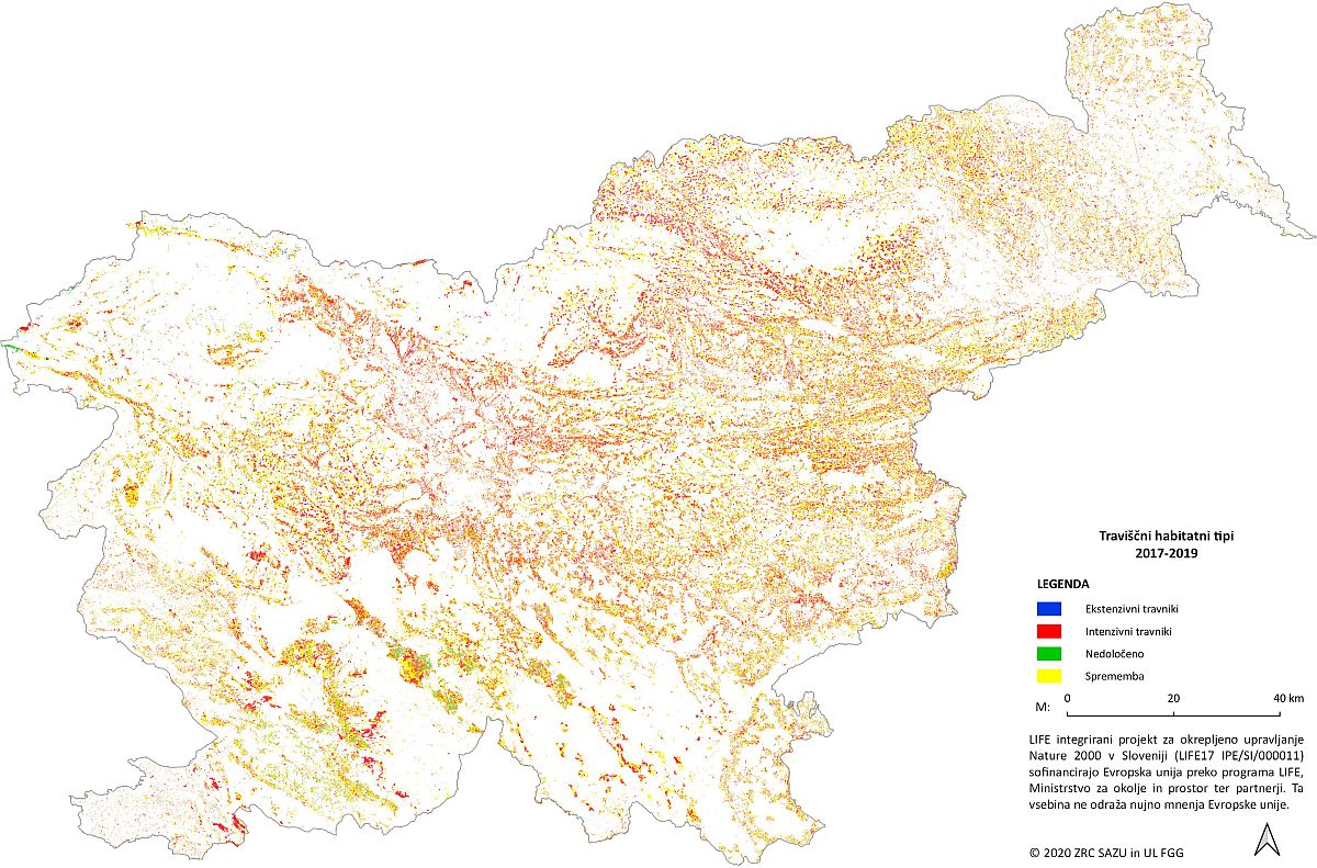 Areas of intensive and extensive grasslands: matching in calculations for all studied years 2017, 2018 and 2019.