Project Multilingual dictionary of geoinformatics Project Duration: 1 September 2021–31 March 2023 Project Leader: Prof. Anka Lisec, PhD Code: V2-2133
Project Development of system for usage of remote sensing data (incl. feasibility study) – case study to monitor agricultural land (permanent grassland and soil wetness) Project Duration: 6 August 2021–5 February 2023 Project Leader: Tatjana Veljanovski, PhD
Project CEOIS2 – Improvement, Adaptation and Implementation of previously developed Customised Earth Observation Services for Improving Water Supply Management in Uganda Project Duration: 1 June 2021–28 February 2022 Project Leader: Matjaž Ivačič, MSc
Project Ecophysiological, morphological and growth response of fir and beech along geographical gradient – basis for predicting future development trends Project Duration: 11 January 2021–30 October 2024 Code: J4-3086 (C)
Project QGIS RVT Module (suitable for use with Mac OS) Project Duration: 10 November 2020–27 January 2021
Project Contextualization of EO data for a deeper understanding of river environment changes in Southeast Europe Project Duration: 1 September 2020–29 April 2022 Project Leader: Urša Kanjir, PhD
Project Artificial Intelligence toolbox for Earth Observation Project Duration: 5 May 2020–5 November 2021 Project Leader: dr. Dragi Kocev
Project Sustainable operation and maintenance of a Drought User Service Project Duration: 5 May 2020–2 November 2020 Project Leader: Žiga Kokalj
Project 
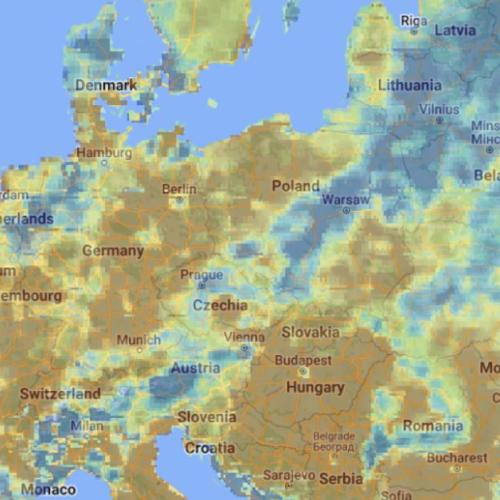
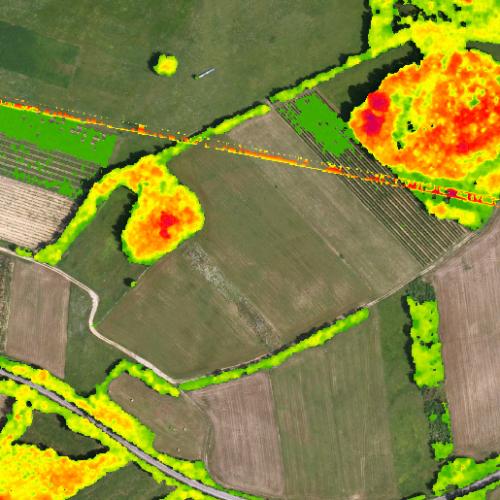
Feasibility study and mapping of vegetative landscape structures important for biodiversity and climate change mitigation with remote sensing Project Duration: 9 October 2019–31 July 2020 Project Leader: izr. prof. dr. Žiga Kokalj
Project Overview and testing of a sustainable Drought User Service Project Duration: 23 July 2019–22 November 2019