SILIS - Satellite images for a Slovenian land information system
Principal Investigator at ZRC SAZU
Žiga Kokalj, PhD, assoc. prof.-
Acronym
SILIS
Project Team
Tatjana Veljanovski, PhD, Aleš Marsetič, PhD-
Duration
15 April 2015–14 April 2017 -
Project Leader
Žiga Kokalj, PhD
-
Financial Source
Evropska vesoljska agencija
Partners
Sinergise
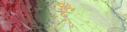
The main aim of the SILIS project was to develop a prototype of an accurate, countrywide, and harmonised land information system that covers present and future needs of its users in Slovenia and is designed for straightforward continuous updating.
The explicit knowledge about current land cover, land use, and their changes, plays a crucial role in spatial management at all administrative levels. Earth observation based land mapping in Slovenia has a long and successful tradition; it has started already in 1970’s; however, an accurate, countrywide land information system, designed for straightforward continuous updating was still lacking.
The main technical goals of the project were therefore to:
- transfer and adapt methodologies already proven to be successful in similar landscapes and using comparable input data, i.e. Land Information System Austria (LISA) and CadasterEnvironment Austria, and to
- enhance the practice with integrated automatic processing workflow for data preparation and to further facilitate automatic updating procedure.
We assessed the situation regarding land information facilities, models, and derived services needed to meet the demand in Slovenia regarding production of LU/LC maps.