Contextualization of EO data for a deeper understanding of river environment changes in Southeast Europe
Principal Investigator at ZRC SAZU
Urša Kanjir, PhD-
Acronym
EO-Context
Project Team
Nataša Gregorič Bon, PhD, Liza Stančič, PhD, Damir Josipovič, PhD-
Duration
1 September 2020–29 April 2022 -
Lead Partner
-
Project Leader
-
Financial Source
European Space Agency
Partners
Institute for Ethnic Studies
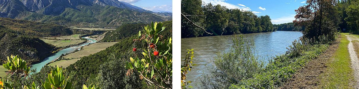
One of the main objectives of the project was to develop methods and approaches for an integrated and deeper understanding of the rivers and their surroundings along the Mura (north-east Slovenia) and the Vjosa rivers (southern Albania). Based on the analysis of long-term satellite data (period of forty years) and the explanation of their results to the general public, the project combined methods of remote sensing, anthropology and geography in an innovative way. The analysis of physically-geographically comparable rivers, with the only exception in the intensity of hydroelectric infrastructure, helped to understand how infrastructural and other interventions at the relatively dammed Mura river can change the river environment at the currently undammed Vjosa river. A synergistic translation and interpretation of Earth observation (EO) data (Landsat and Sentinel-2) and ethnographic material that illuminates socio-cultural understandings and experiences with river environments allowed to assess and explain the correlation between people and their (river) environment. This project focused on changes in land use/land cover and gravel deposits (gravel bars) and explained the experiences of such changes by residents along the mentioned border rivers in Slovenia and Albania.
The main outcome of the project was the development of a so-called StoryMap or knowledge base, with which we translated specific and expert-oriented analysis of satellite images into user-friendly, publicly available information that meets the needs of various NGOs, initiatives and local communities. This participatory approach combined local knowledge and experience of riverine landscapes with the analysis of EO data and contributed to a deeper understanding of the environment and, last but not least, to the security of water and food supplies. The research results can be found at the project web page.