Testing the feasibility and implementation of remote sensing mapping of grassland habitat types with a focus on high-resolution satellite imagery and the differentiation of extensive grassland habitat types
Principal Investigator at ZRC SAZU
Tatjana Veljanovski, PhD-
Original Title
Testiranje možnosti in izvedba kartiranja traviščnih habitatnih tipov z daljinskim zaznavanjem s poudarkom na satelitskih posnetkih visoke ločljivosti in ločevanju habitatnih tipov ekstenzivnih travišč
-
Acronym
VHR Travišča
Project Team
Urša Kanjir, PhD, Peter Pehani, Prof. Urban Šilc, PhD, Ana Potočnik Buhvald , Prof. Krištof Oštir, PhD, Filip Küzmič, PhD-
ARIS Project ID
2560 – 24 – 310019
-
Duration
1 September 2024–30 November 2025 -
Project Leader
-
Financial Source
Ministrstvo na naravne vire in prostor

Partners
University of Ljubljana, Faculty of Civil and Geodetic Engineering
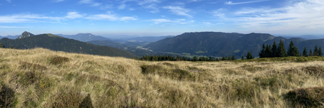
In the project task we develop and test approaches to differentiate between habitat types of extensive grasslands in several small and relatively homogeneous areas of grasslands in Slovenia. The main objective is to explore the potential of satellite remote sensing for identifying and monitoring the status of extensive grassland habitat types and to find out to what extent it can complement field mapping of habitat types. We will focus on Natura 2000 grassland areas where the use of field mapping methods at sufficiently frequent intervals is difficult. We will build on a method that uses time series of optical Sentinel-2 and PlanetScope satellite images in combination with very high resolution Pléiades Neo (or equivalent) images.
We will assess the suitability of remote sensing data for the identification and differentiation of four widespread grassland habitat types:
- Eurasian dry and semi-arid secondary grasslands, predominantly on carbonates (PHYSIS 34.3),
- Sub-Mediterranean and Mediterranean-montane dry and semi-dry grasslands (PHYSIS 34.7),
- Oligotrophic wet grasslands (PHYSIS 37.3) and
- Mesotrophic to eutrophic cultivated grassland (PHYSIS 38.2).
The methodology for identifying habitat types will be defined and adapted to the specifics of the observed habitat types and the specifics of the selected Natura 2000 sites where field mapping of habitat types has been carried out in recent years under the auspices of Institute of the Republic of Slovenia for Nature Conservation (https://zrsvn-varstvonarave.si/irsnc/):
- Ljubljana Marshes,
- Goričko,
- Planinsko lake and
- Karst - karst grassland.
In addition to the satellite time series, other environmental variables such as slope, elevation, orientation, hydrological conditions, soil and geological substrate, moisture conditions, etc. will be also meaningfully included in the modelling. Grassland parameters that could be used to assess the habitat type and that can be observed with satellite data include:
- the determination of the timing of the first mowing,
- determining the number of mowing events and focussing on grasslands that are only mowed 2-3 times per year (extensive grassland),
- machine learning of the presence of each habitat type based on the ZRSVN field mapping samples of recent years.
We will validate the model results using various independent inventory data and collections from the Jovan Hadži Institute of Biology (https://bijh.zrc-sazu.si/en ) and provide corresponding estimates of modelling performance.
In addition, we will test the possibility of identifying individual stands of selected invasive non-native plants or a selected grassland habitat type. For the identification and separation of habitat types or invasive species from native vegetation, we will test the LightGBM machine learning algorithm and other classifiers in the case of a sufficient training sample and investigate the role and most useful contribution of satellite imagery spectral bands as indicators of vegetation features and the role of environmental variables on the quality and reliability of grasland habitat type detection. On this basis, we will be able to formulate guidelines for appropriate and optimal data selection in discriminating grassland habitat types and point out current technological and methodological limitations.