Sky-View Factor Based Visualization
Project Team
Prof. Krištof Oštir, PhD, Peter Pehani, Žiga Kokalj, PhD, assoc. prof.-
Duration
1 February 2010 -
Project Leader
Klemen Zakšek, PhD (University of Hamburg, Institute of Geophysics)
Sky-View Factor computation tool is a part of Relief Visualization Toolbox. Its description, downloads and examples were moved to a new RVT page.
The most frequently used relief visualization technique - analytical hill-shading - is based on the direct illumination that makes possible to intuitively recognize relief features. However, it also has several drawbacks. The most critical are its inability to represent linear objects that lie parallel to the direction of the light source and saturation of shadow areas.
To overcome these problems that originate in the charcteristics of direct illumination we have developed a visualization method which is based on diffuse illumination. A good proxy for the diffuse illumination is Sky-View Factor (SVF) which is the portion of the visible sky. The visible sky is obscured by the relief. If we assume that the diffuse illumination is isotropic, the places that see large portion of the sky are brighter than those where only a small portion of the sky is visible.
Applying the SVF for visualization purposes gives advantages over other techniques because it reveals relief features without any "sharp edges" while preserving the perception of general topography. Rather than just presenting or visualizing the same information in a new way, it extracts new information that can be further processed.
SVF can be effectively used in scientific fields in which digital elevation model visualizations and automatic feature extraction techniques are indispensable, e.g. geography, geomorphology, cartography, hydrology, glaciology, forestry, studies of the past cultural and natural landscapes, and disaster management.
Downloads
Sky-View Factor computation tool is a part of Relief Visualization Toolbox.
Further reading
- Zakšek, K., Oštir, K., Kokalj, Ž., 2011. Sky-View Factor as a Relief Visualization Technique. Remote Sensing 3: 398-415.
Images
Note: click to enlarge, press ESC to quit.
| Sky-View Factor is defined by the share of the visible sky (Ω) above a certain observation point. The algorithm computes vertical elevation angle of the horizon γi in n directions to the specified radius R. | |
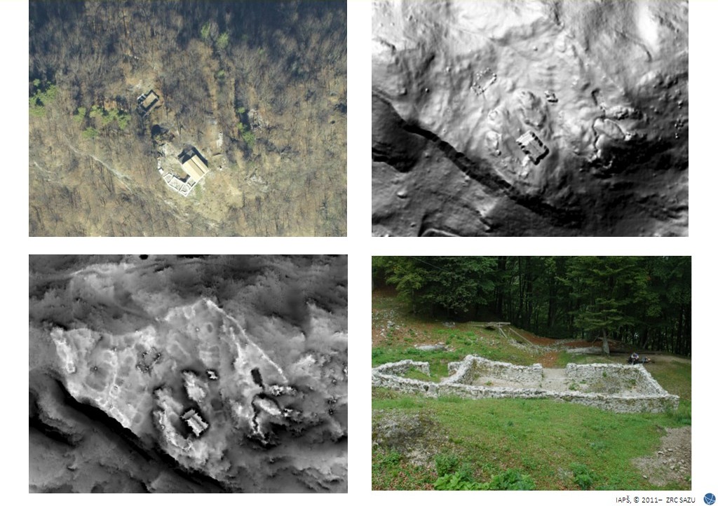
 | Method of Sky-View Factor is based on computation of horizon elevation angle in n directions (in this particular case: n = 8).. |
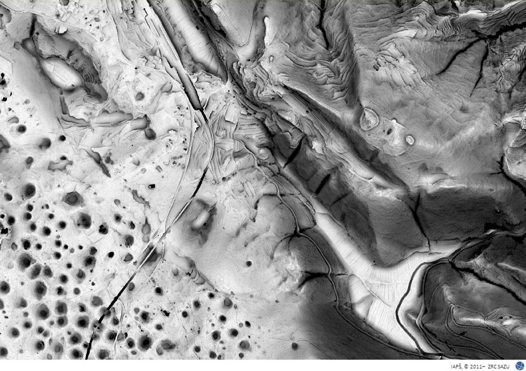
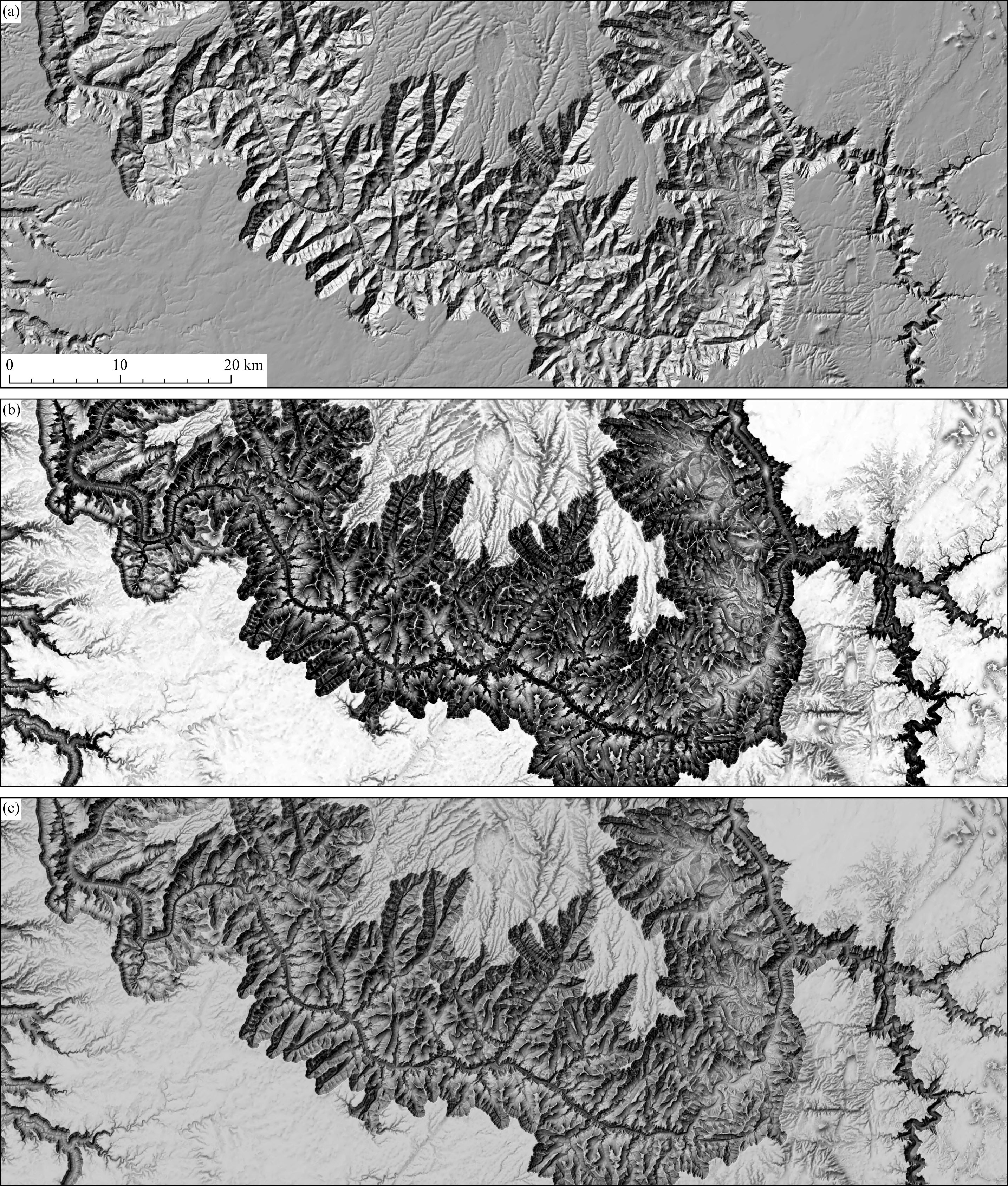 | Even though the rugged relief is appropriately represented by hill-shading – as shown in (a), the legibility of its features is enhanced with the use of SVF (b), and even more so when both methods are combined (c). The combination is especially suitable for cartographic purposes. Grand Canyon, Arizona, USA. Data source USGS (1” NED). SVF was computed in 16 directions with a 300 m search radius. |
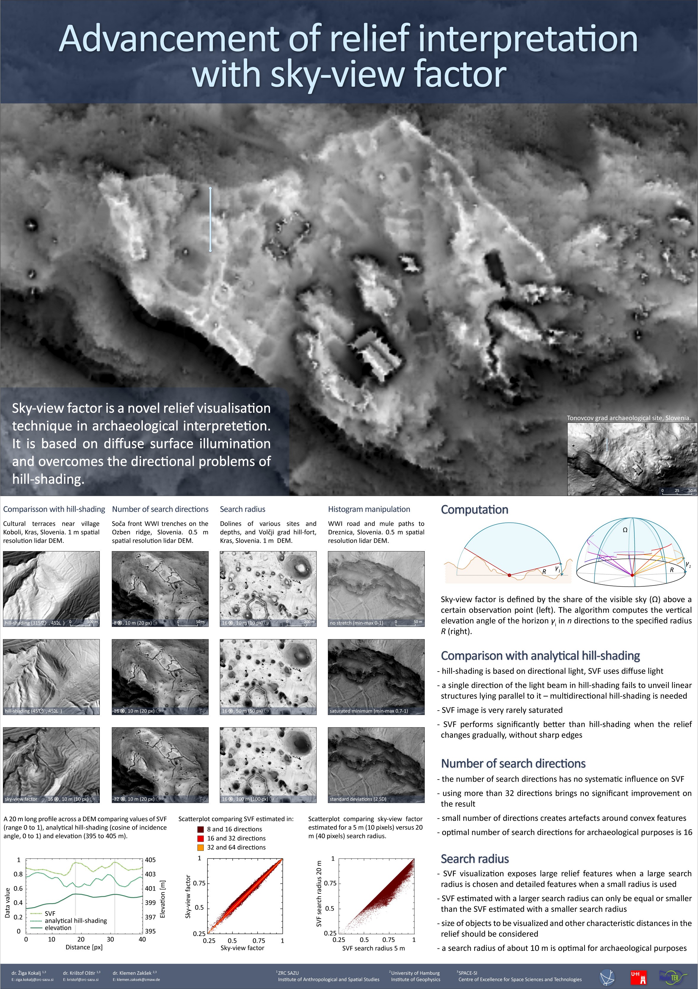 | Poster 'Advencement of Relief Interpretation with Sky-View Factor,' presented on the conference Aerial Archaeology Reserch Group, Bucharest, Romania, September 15th – 18th 2010. |
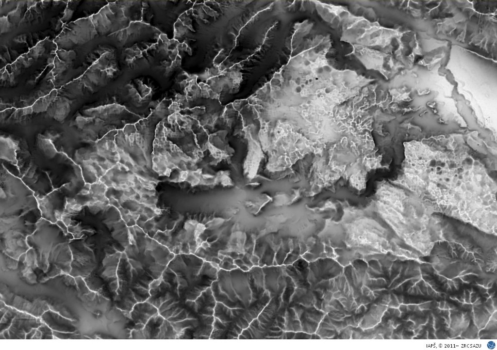
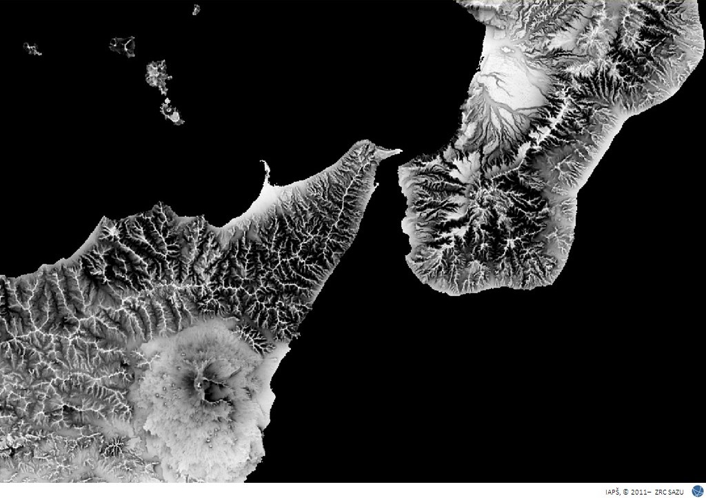
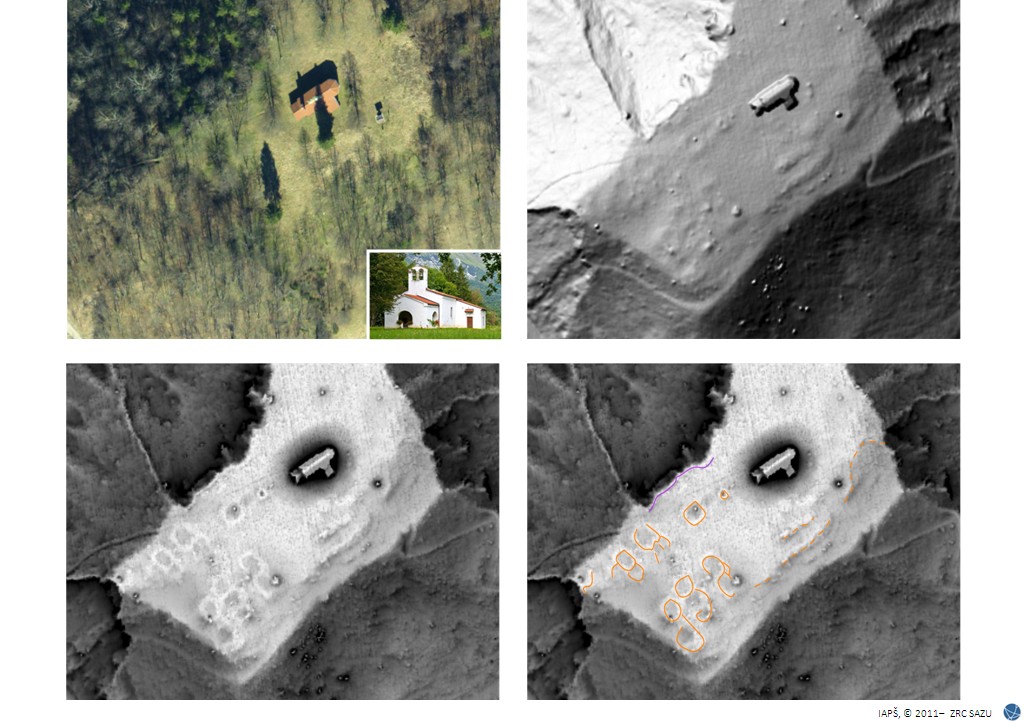
Gallery of visualisations